A bike ride around Barnston Island

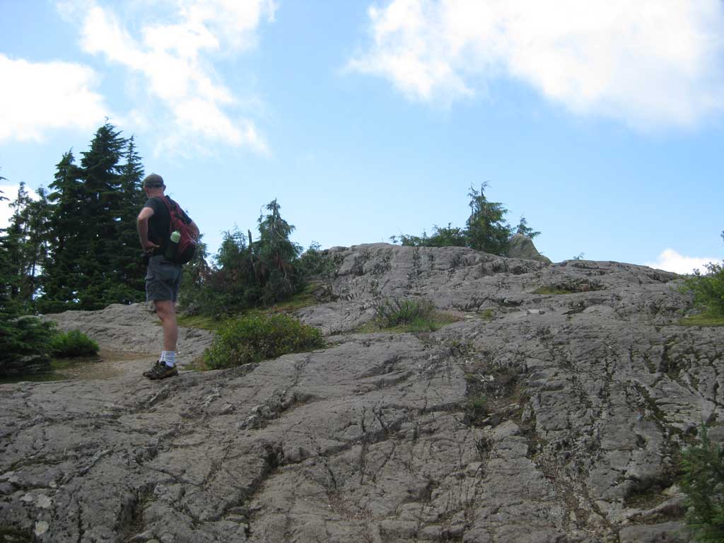
Jeff suggested a bike ride around Barnston Island, so today we packed up the bikes and headed over for a leisurely 10 km loop around the island, all of which is private land, save for two tiny regional parks, Robert Point and Mann Point. The former has a couple of picnic tables and paths out onto a sandy beach, while the latter is all beach.

The weather was the same smoke haze we’ve had for most of the past few weeks, giving photos of the day a weird alien light. It was otherwise pleasantly warm, not hot, though it did start feeling muggy by early afternoon.

The full gallery of photos can be seen here: Barnston Island photo gallery

The ferry ride, which is really a tugboat affixed to a barge, takes just over two minutes. Once on the island, we headed counter-clockwise. I’m not sure why, we just did. One site suggests going clockwise, though again I’m not sure why. There’s not enough traffic to really make a difference either way.

On the ferry heading over to Barnston Island.

Speaking of traffic, we encountered numerous cyclists and a total of five motor vehicles–two cars, two truck and a motorcycle, for an average of one vehicle every two km. All of them came from the opposite direction, so I say we chose the right way to travel.

Most of the land is agricultural and Avalon Dairy has a large farm here, full of mooing cows. The Katzie First Nation also has a reserve here on the south side, though the majority of it is located across the river in Pitt Meadows. Mann Point also offers a nice view of the Golden Ears Bridge, if you like looking at bridges with weird names.

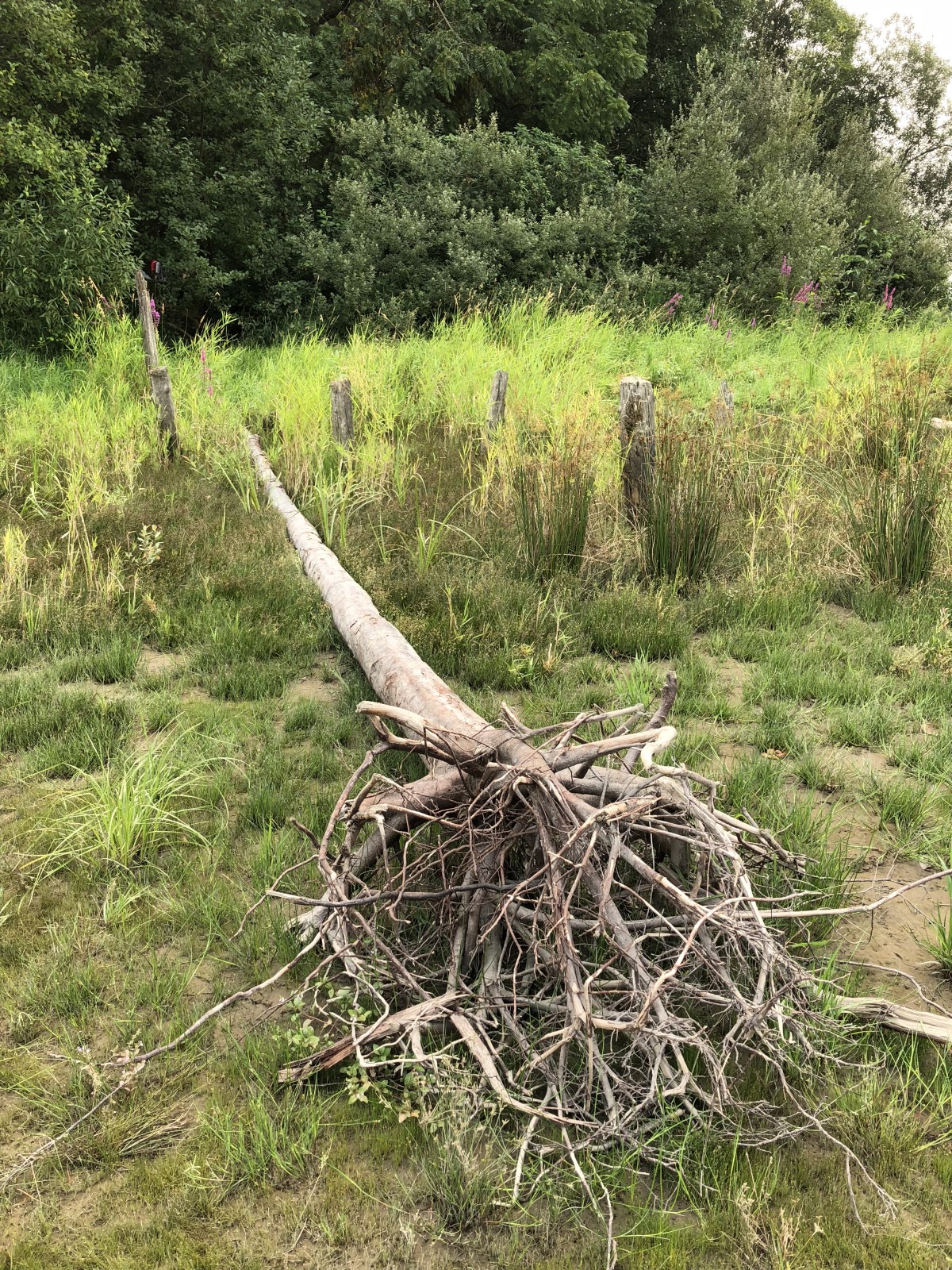
Our first stop was at Robert Point. This is not so much a park as a parket or perhaps a parkling. There are a few picnic tables on a small patch of grass, a washroom, some trash bins and that’s pretty much it. A group of people were there and because they were a group, they pretty much filled the entire park. They were playing, of all things, croquet. The park does not really lend itself to a good croquet layout, but they didn’t seem to mind. We went down to the beach, checked out the log booms, then headed back to the road and onward to Mann Point.

Ex-tree at Robert Point.

Mann Point is where we spent most of our time, stopping at the beach to chill out, have some lunch and in Jeff’s case, work on the essential all-body tan. I opted to explore along the shore and edges of the beach and grabbed a few photos. I was surprised that there was no one else on the beach. It’s not a huge place like the beach at English Bay, but I expected there’d be at least someone else there tromping around in the sand and cursing the smoke-filled sky.

Setting up for a picnic lunch at Mann Point.

A couple of guys did briefly show up on bikes, but turned around when they saw the beach because riding bikes on a sandy beach is basically impossible.

We left Mann Point and continued on back around to the ferry dock, passing by fresh skid marks on one of the smoother sections of road (is this what the locals do for fun?), an abandoned house being slowly consumed by vegetation, and several other properties that actually looked pretty snazzy. In all, it was a perfectly pleasant way to spend a few hours.

The long way to the shopping mall

Today it was pleasant and mild and I went to Lougheed Mall, except I decided semi-spontaneously to detour a bit at Burnaby Lake, to see what the trail is like in anticipation of actually maybe running there again soon™.

I got distracted by the sun or something and ended up doing a full loop around the lake. I know my legs will regret this tomorrow as I am definitely not in peak condition after no exercise for the past week and a half.

Still, it was nice to be back there. The trail was in good shape, with only a few dabs of snow here and there, mostly off to the sides. A few sections have been patched up, which was nice to see.

Signs reported a delay in the construction of the new bridge at Still Creek, but the supports for it are now in place. It will sit directly east of the current bridge. They still say there will be no access for three weeks, but I’m reasonably confident they’ll finish early. I’m curious to see what the new bridge will look like. I’m pretty sure I have a photo or two of the current one around somewhere.

Speaking of photos, here’s a shot on the north side of the lake, just before you get to the fork for the Spruce Loop, approaching from the west. I actually sweated! My average pace was 9:26/km, which is fairly zippy considering how inactive I’ve been. The total walk, in which I stopped only to pee (twice) took just over two hours and thirty-two minutes. Surprisingly my feet never got sore. My left knee did, which proves it may just be a thing now–I’ll ask my doctor about it when I see him in a few weeks. The knee recovers fairly quickly, though.

Scenery:

Burnaby Lake March 3, 2018

I like shots like this because you can pretend you’re actually in the woods and not in the middle of a huge urban sprawl.

Also, I hate to say this, Apple, but I honestly don’t see a difference in the images from my iPhone 8 compared to my iPhone 6. I know they should be better and maybe they are better, but I ain’t seeing it. They’re still nice! And I’m willing to admit I have pretty much no eye for photography. I point the camera (or phone), try to hold still and press the button. Caveman photography, basically.

Manning Park 2017: Day 2, Wednesday, July 5, 2017

Trails both open and closed, terrifying heights of terror

Day 2 started bright and early with a home-cooked breakfast of yummy pancakes and bacon. Thanks, Aunt Jemima!

Our first adventure of the day was to find internet. It turns out the boonies are much better equipped for booze than modern communications technology. Undaunted, we headed to the Cascades Lookout, a 16 km drive straight up the mountain (well, with a few switchbacks included) where a park ranger had promised the possibility of cell coverage, depending on provider.

The drive up was slow and terrifying for anyone with a fear of heights. Like me, for example. Once up top, we parked and indeed found we had two bars of coverage, enough to say hi on Facebook and sync all-important MyFitnessPal data. Those tasks completed, we set off on a couple of hikes, starting with the Paintbrush Trail, so-named because the trail is littered with discarded paintbrushes left by frustrated painters who came up to paint, only to find everything already painted in lush green alpine meadows and wildflowers.

Or maybe it’s because the meadows up here are filled with alpine blooms. We did see more than a few flowers but found out they are actually blooming later than usual this year due to the hard winter, so the big show will be missed, alas.

Paintbrush Trail
Standing on the Paintbrush Trail, contemplating paintbrushes. And trails.
All hail technology (and two bars of cell coverage on top of a mountain)
Jeff midway down the stairs taking a picture of me…
…while I take a picture of him from the top of the stairs.

After looping back around we saw a van pull up in the parking lot and, weirdly, the same Alpenhorn quintet, still in costume, came piling out with horns in tow.

Here’s hoping the fourth guy didn’t accidentally elbow the fifth guy. It was a long way down.

It turned out they actually had a second concert up here. It was announced and everything, though we missed the announcement. It was still bizarre to have them show up again. I’m waiting for their next sudden appearance.

We returned to the camp and had leftover pizza for lunch. It was surprisingly good. Waste not, want not and all that. After we resumed more hikes, heading along Lightning Lake to Flash Lake (the person who named the latter deserves a serious paddling). We had planned on looping Flash Lake until we met this little fellow:

Trail closed due to CAUTION sign in the way

We doubled back and headed over Rainbow Bridge. Midway across Jeff ran into a co-worker from UBC. Another weird coincidence. The Alpenhorn players did not suddenly appear, though. Not yet, anyway.

The total hike was still about 9 km in total. I used my watch to record it as a workout and brilliantly ended the workout early two times, so according to the watch, it was a long hike followed by a short hike followed by a “this is not really a hike” hike.

Before dinner, we went to the Manning Park Resort and Lodge and looked around the store for maps, souvenirs, and hidden Alpenhorn players. We found a map, I got a souvenir mug for Jeff, handy for imbibing liquids, and got a zippered hoodie for myself because I was dumb and forgot to bring a jacket. That wouldn’t be a problem if the whole night part of camping didn’t happen, but it does, so the hoodie will offer warmth as I remind myself not to forget things next time.

Seen at the Manning Park Resort: Statue recounting bear attacked by legendary nose-eating salmon

Dinner was BBQ chicken with potatoes and veggies and was extra yummy because were eating out in spectacular scenery up in the mountains instead of the couch, which offers little in the way of spectacular scenery. We made s’mores over the campfire after, fulfilling one of the mandatory camping requirements.

Later as it got dark we waited ’round the campfire for the stars to come out. Jeff eventually gave up waiting and went to bed. I kept waiting but when it was still light over an hour after sunset I also gave up. Stupid stars. I went to bed and dreamed about them coming out instead.

And thus ended Day 2.

Save

Manning Park 2017: Day 1, Tuesday July 4th

Heading out, the drive, the marmots, the Alpenhorns

Having never had a formal vacation together, Jeff and I decided to do a five day trip to Manning Park, about 220 km east of Vancovuer as the crow flies, assuming the crow flies along the highway.

Day One found us heading out on July 4, humming “America the Beautiful” to commemorate U.S. Independence Day.

We left New Westminster around 9:30 or so and conditions were near-perfect, with temperatures in the mid-20s under clear skies. We picked up the trailer in Langley (and brother, that thing is heavy), then began the first leg of our trek, which would take us to Chilliwack for gas and propane. There wasn’t much to see in Chilliwack but here’s a picture of Vedder Road, named after Pearl Jam vocalist Eddie Vedder, or so the legend goes.

The splendor of Chilliwack

And here’s a giant Canadian flag that was flying outside the service station. This ends the Chilliwack portion of our vacation:

A giant Canadian flag for the 4th of July

We headed off along Highway 3 (the Crow’s Nest, as it’s called, possibly because of something to do with crows) which became more snake-like than crow-like as it wound through the mountains.

Shortly after noon we arrived at Hope, a bustling metropolis with internet and everything. It was also windy enough that I saw dust devils forming in the Save-On Foods parking lot.

We had lunch at Home, a very busy restaurant, perhaps because people think it is their actual home and always go there to eat and wonder why mom comes around with a pad of paper to ask what you’re having for dinner instead of just cooking meatloaf again and telling you that you’ll like it.

Here is an obligatory shot of my hot turkey sandwich (I didn’t eat the cranberry sauce because it was cranberry sauce):

I don't know why I was stabbing my sandwich with a knife
I don’t know why I was stabbing my sandwich with a knife

Jeff had a BLT sandwich, which you can see at the top of the photo. I want one now.

We bought a couple hundred dollars in groceries, enough for at least several meals. Jeff may or may not have acquired liquor.

And then we were off.

Leaving Hope behind
Leaving Hope behind

Around 3 p.m. we arrived at Lightning Lake Campground and meandered to our spot. It’s a nice spot. It has a picnic table, a fire ring to prevent people from burning down the entire forest, and a forest, which surrounds it. We set up without injury or incident.

The campsite!
The campsite!

We went on a hike around Lightning Lake, called, cleverly enough, the Lightning Lake Loop.

Heading off around Lightning Lake. It's important to stay hydrated!
Heading off around Lightning Lake. It’s important to stay hydrated!
Rainbow Bridge
Rainbow Bridge. Diving allowed–no. Bears–maybe.
Jeff was well-hydrated by the end of the hike around the lake.
Jeff was well-hydrated by the end of the hike. And half-naked.

In the distance of the shot below you can see Mt. Frosty, the highest point in Manning Park, so-named as it is the burial site of Frosty the Snowman.

Lightning Lake view
There were some pretty views of the lake as we made our way around it.

On the last leg of the loop we saw a place that rents canoes for $20 an hour, with an option to buy after four. We declined and instead admired the water from the shore.

There was also a field filled with marmots, roughly a million or so. Here’s just one:

Marmots all the way down
The handsome knee you see is mine. Crouching down is marmot-speak for “may have food.”

One little kid was petting them. He probably has scurvy now or whatever it is you get from marmots.

They squeaked a lot. I did not pet them.

In the evening we went to the amphitheater to watch an Alpenhorn quintet in from Germany get eaten alive by mosquitoes. They also played their Alphenhorns. It was unique and interesting, even if a lot of the pieces sounded the same. I was mildly disappointed they did not end with “Stairway to Heaven.”

Alpenhorn quintet
Alpenhorn quintet that flew in straight from Germany (and boy, were there arms tired).

We did not stay for the nature trivia quiz after. The parks person hosting it noted that there would be no cheating as there is no Wi-Fi at the campsite. I imagine some were doubly hurt, as the symbol for the amphitheater looks just like a Wi-Fi logo:

Amphitheater sign
This is not a Wi-Fi sign.

We had hot dogs roasted on the campfire, as one is duty-bound to do when camping. Here’s our first fire, just getting started.

campfire
Campfire!

And then we slept, having survived an entire afternoon and evening without internet access. I only banged my head once getting up to use the loo, something I consider a minor triumph. I don’t do well in confined spaces.

In all, a good first day.

Save

Save

Save

The cat in the lake

Today I decided to go for a nice walk around Burnaby Lake because it was really hot and I’m kind of dumb. But it did allow me to see that the resurfacing of the Southshore trail is pretty much complete, so my nemesis the excavator will probably not be there to try to run me down tomorrow.

Probably.

In the meantime, as I walked and sweated on my clockwise jaunt, I crossed the 4 km mark, ventured over the rowing pavilion parking lot and entered a stretch of the trail that is characterized by tall grass on the lake-side, giving the area a kind of everglade feel to it. At least it’s what I think an everglade would feel like. I confess I haven’t been to one, not even a fake one like they probably have at Disney World.

I noticed a not-quite-small brown dog sort of shimmying into the tall grass, perhaps to get out of the sun. It was an odd kind of move and looking at the trail up ahead I could not see any kind of owner for said dog. Also odd.

But it was not a dog. It was this:

Big kitty at lake
I think this is a lynx, a bobcat or more likely a lynx/bobcat hybrid. A boblynx.

I apologize for the less-than-stellar quality of the shot. The cat was in the shade and I was reluctant to call it out into the sun, since it was a wild animal and could have ripped my throat open if so inclined.

My first thought was a lynx. I later looked at lynx photos and it appears to have characteristics of both a lynx and a bobcat and hybrids are possible, so I think this was the possibly rare boblynx.

It seemed a bit skittish and unsure and wasn’t acting at all aggressive. I remained calm, trying to remember what I’d seen on one of those TV shows, Survive or DIE! or something like that. They were talking about what to do when you encounter a mountain lion but maybe the advice would translate on a scaled-down wild cat. As I recalled, you are supposed to make noise, stand your ground and if American, shoot it repeatedly with the assault rifle you’re probably carrying. Also something about throwing rocks to prove you’re the alpha. I didn’t have any rocks and throwing them at a non-aggressive animal literally less than two meters away from me did not seem like a good idea.

I clapped my hands and told it to shoo, to scoot. It stood there and seemed embarrassed for me. I don’t blame it, really. I then took a few pictures while it just hung around, undecided on what to do.

At this point I had three choices:

  1. Turn around and head back
  2. Proceed forward, giving the cat as wide a berth as possible
  3. Stand there until one of us got bored and left

Option #1 seemed unwise. Turning your back on a wild animal is never a good idea. Turning your back on a domestic animal is never a good idea. I don’t trust bobcats or cows.

Option #3 seemed problematic as I have a high threshold for boredom and it’s possible the cat had no concept of boredom and would wait until it got hungry instead, at which point I would be the most convenient food source.

I opted for #2 and as soon as I took one step forward, the cat majestically leaped into the grass and disappeared. I mean, that sucker cleared about a meter from a standing position. It was scary and impressive.

I continued my walk, keeping an eye behind me until I was safely out of the immediate area.

I expect to see a giraffe the next time I’m at the lake.

A little trip down Burnaby Mountain (no actual tripping involved)

Today Jeff and I went on our first hike in a good long while, a relatively gentle saunter down various connecting trails on Burnaby Mountain. The weather was sunny and warm but fortunately not Africa hot. We encountered a few cyclists but got out of the way without incident each time. One of them approaching from behind tipped us off to his presence with the world’s screechiest bicycle brakes. Seriously, an entire can of WD-40 may not have been enough to quiet that thing.

I knew there would be tree roots a-plenty on the trails and indeed, I tripped up on several of them, but because I was walking and looking down instead of running and gazing off at some non-specific thing up ahead, it was easy to recover each time and so I emerged at the bottom of the mountain sweaty but otherwise unscathed.

I only took two pictures because as pretty as trees on a mountain are, I didn’t have the time or inclination (or skill) to make fairly generic nature shots look like more than generic nature shots. But trust me, it was pretty.

Here is Jeff posing on the same bridge I froze my butt on when we did a similar hike in the winter. He looks much happier than I did:

Jeff posing on a bridge at Burnaby Mountain

The only other picture I took is of the vehicle cast down on the mountain in the olden days when the area was still a logging operation. Apparently some people tried to make a trail down to it or something, perhaps as a weirdly unprofitable salvage operation, as signs and fencing make it clear you are not meant to go down to touch the car:

Do not go to the dilapidated car

All in all, it was a pleasant little outing.

A walk with ducks, fresh gravel and wooden stickmen

Today Jeff and I went for a walk around Burnaby Lake, the first time I’ve been there in over two months and since The Big Blow of 2015. It was cooler than August but not really wetter, if you don’t count the lush athletic fields being giant sponges of water.

I wore my newish Peregrine 5 runners to give them another testing and they clearly do not get along with my weird left foot, as said foot started hurting almost right away. This makes me sad because I hate shopping for shoes. The pain was more annoying than anything, at least.

As we approached Hume Park, Jeff pulled out his iPhone and began setting about finding a nearby geocache, which are basically little goodies stashed away outdoors and contain sheets you can use to record that you have found the cache. The first one Jeff found was the weirdest, a wooden stickman that looked like a prop from The Blair Witch Project. Here I am holding it with my best goofy face on:

wooden stickman
Demonstrating the proper way to hold a stickman made of wood

Jeff ended up finding five others but none came close to the clever and odd design of the stickman. They were mostly water-logged sheets of paper rolled up inside leaky pill bottles.

We looked for a few caches along the Brunette River but didn’t have much luck there. We did notice the river was replete with salmon returning to the lake to spawn and die, as is their tragic lot on life. Many were quite big. Others were big and dead. And stinky. We didn’t linger.

Less stinky were a bunch of ducks near another geocache at the lake. I have never before observed a group of ducks all lined up on a tree branch before. I have now:

ducks in a row
Ducks in a row

We also watched as a gaggle of geese nearly flew into someone’s model airplane buzzing over the athletic field and enjoyed the newly resurfaced stretch of trail starting near Silver Creek. This has always been my least favorite part of the lake trail for runs, as it is very uneven and has steep sides that all but whisper, “C’mere and twist your ankle!” No more! It is now a smooth pedestrian superhighway. I expect erosion will take care of this in time but for now it’s a nice improvement. It also looks conspicuously unnatural.

delicious fresh gravel
Fresh gravel, perfect for walking on. NO BIKES.

Alas, by the time we reached the halfway point of our journey ’round the lake we both had sore feet and elected to take the SkyTrain back from the Sperling/Burnaby Lake station. We still covered about 11 km, though, so not too shabby for my first real walk in months.

Next time I’ll don better footwear or use some kind of magical orthopedic device that will make my left foot feel happy and non-hurting. I hate that foot.

The Dog Mountain hike (includes actual dogs)

The rocky summit. And Jeff!

With the weather looking pleasant we decided today would be a good day for a hike. We first thought to return to Brothers Creek, to see what it looked like when you aren’t up to your waist in snow but given that it’s a good four hours or so, Jeff suggested Dog Mountain instead.

Dog Mountain is billed as an easy hike and the roundtrip would only take us about two hours. The reward at the end is a spectacular view of the Lower Mainland. We piled into the truck with water bottles and granola bars at the ready and arrived in the early afternoon at the ski area atop Mount Seymour. The place was fairly brimming with people off to touch nature while it wasn’t snowed under.

We set off sans the usual walking sticks but an easy hike with minimal elevation gain (estimated at around 25 m on the way in, according to Jeff’s GPS app) shouldn’t require them. As it turned out they would have been a bit handy because while the trail is not treacherous or unduly steep, it does involve a lot of up and down climbing over rocky and root-filled terrain, one of those ‘pick every step’ kind of hikes with only a few respites.

One such respite came a km in at First Lake, a small and positively quaint mountain-top lake with wild grass growing around it. We paused to take in the scenery but forged ahead, as it was only another 1.5 km to get to the scenic vista.

Further along we encountered the remains of last winter’s snow pack. There was enough to make a snowman. We did not do so.

A lot of the trail was rather muddy. Because I have the world’s worst balance I made sure to get my feet as muddy as possible, in particular my right foot. At one point the path consisted of water, mud and a few small strategically-placed rocks to allow relatively dry passage. I took two successful steps and was making the third when my balance shifted backward. To keep from falling I set my right foot down in the mire. It squished nicely.

We both ended up with mud smeared over our calves. I’m not even sure how that happened. I also stepped in some mud on the way back and managed to make it squip over the edge of the trail, flying down and plopping into water below us, a mildly impressive trick I could never pull off again.

And yes, dogs. A number of people–and there were quite a few on the trail–had brought their dogs with them. The bigger ones in particular seemed to handle the rugged terrain quite nicely, what with the four feet and all.

Jeff compared me to a mountain goat when I stood glued to the side of a rock face as I contemplated my next move but I don’t think mountain goats contemplate all that much because they have four legs and a proper sense of balance.

We reached the vista just over an hour into the hike and the view was indeed spectacular, although it was dulled somewhat by fairly thick haze. The people around us were feeding stellar jays straight from the hand. Our food, however, was not for the birds, so we ate it ourselves.

The trip back seemed quicker, as it often does and apart from dinging an ankle on a rock and getting a small cut as a result, we returned to the truck without incident.

Overall it was a fun afternoon, though not quite what I expected in terms of terrain (when I hear that a trail has no or minimal elevation gain I tend to think of it as groomed and civilized, which this one is not). We may return in the winter to snowshoe the whole thing. That ought to be good for a few (dozen( sore muscles.

Gallery

The trail less traveled (for good reason)

I wanted to get some photos of the detour on my run route so today Jeff and headed out on a partial walk around Burnaby Lake, covering the south shore. The total distance was around 7 km and despite the temperature peaking at 30ºC it didn’t feel too hot thanks to a moderate breeze.

We started by walking from Production Way SkyTrain station to Cariboo Dam then headed to Still Creek, the approximate midway point of the lake trail. Normally we’d head out of the park and up a street to the Burnaby Lake/Sperling SkyTrain station but I had seen an unofficial trail just a little ways up where the Cottonwood Trail starts that looked like it would be a good shortcut — you can see the pedestrian walkway that’s near the station just beyond it. So we took it.

The trail quickly petered away and changed from a discernible path to ‘I knew I should have brought my machete’. The brambles and thick vegetation his stumps and other hazards, though the frequent prickly bushes were hard to miss. When we finally emerged onto the train track (fortunately there was no train parked on that section) we were bleeding, had bug bites and multiple welts from the prickly things. I was itchy as all get-out initially but the itchiness mercifully faded after a little while.

We agreed to not take that ‘route’ again — the same decision everyone else had made based on how quickly the trail came to an end. I’m not sure it was any faster, either.

Here’s one of the photos I took before we lacerated our legs. This is part of the detour I am taking on my runs now and as you can see the name Freeway Trail is apt.

It’s fun for running because there is absolutely no shade.

Diez Vistas hike -or- Why I wish I was a mountain goat

Today Jeff and I set out for our first official™ hike in a year and Jeff opted to take us along the Diez Vistas trail, as 15 km trek above and between Buntzen Lake to the east and Indiand Arm to the west. It took us just under five hours to complete. It is described thusly on the BC Hydro website:

This route is recommended for experienced and fit hikers only. Spanish for “ten views”, the Diez Vistas Trail is aptly named. Offering spectacular views of Vancouver’s waterways and mountains, the Diez Vistas Trail commences near the floating bridge. Travelling uphill into the forest, cross the powerline and pipeline and continue along a series of switchbacks until the trail forks. The left trail leads to a viewpoint overlooking Indian Arm and the right leads to a view of South Beach and across to Eagle Ridge. After reaching the high point where the trails reunite, you travel along a forest trail that terminates at a BC Hydro service road. Keep right and follow the service road and transmission line (the Old Buntzen Lake Trail) back to the Buntzen Lake Trail, where a left turn will take you to the suspension bridge leading to North Beach. From here, follow either Powerhouse Road or the Buntzen Lake Trail back to South Beach.

And now the stats:

  • 15 km hiked
  • 3.1 km/hr average pace
  • 740 m of elevation gained
  • one billion calories burned (okay, more in the range of 2400)

Considering that neither of us are in peak condition and I was coming off a week of not running, not to mention having a still slightly sore back, this was probably more than we should have tackled but it was a fun challenge, even if by the end our feet were aching, our stomachs were grumbling and we both felt very tired.

Living up to its name, Diez Vistas (10 vistas) has lots of viewpoints along the way, though we didn’t check out all of them. The ones we did had spectacular views of Burrard Inlet and Salmon Arm, with the Lower Mainland and Vancouver Island spread out far below.

Much of the ascent and descent is fairly steep and it’s the kind of hiking where you often have to pick where to place your feet, as the path is covered in rock and twisted roots. We each slipped a few times but neither of us fell, something of a miracle for me given my unerring sense of imbalance. We encountered at least a couple dozen people during the hike, not surprising given that it was a Sunday and conditions were mild (the two previous times we hiked in this area it was freezing and pouring with rain, respectively). A pair of smart alecks even jogged past us at one point while we were exhausted enough to be tripping over on our feet. Dang kids young adults.

Click the first image below to view them all in sequence or visit the gallery here at your leisure.

[nggallery id=35]

Burnaby Lake runs: A pictorial guide

Reading about my runs is pretty dry for everyone but me and sometimes even I find it a bit dry. There’s only so many ways to wax poetic about exercise you do multiple times a week.

On August 18, 2011 my partner and I went for a stroll around Burnaby Lake. A full circuit around the lake takes about two hours when walking and covers a little over 10 km. I chronicled our walk in pictures that day and have (8 months later!) sorted them out for perusal.

Burnaby Lake is the largest urban lake in the Lower Mainland/Metro Vancouver area and has more lilypads than any other place on Earth. Or at least it seems that way. There are always plenty of birds splashing about, sunning, eating and doing generally bird-like things, copious numbers of black slugs in the warmer months and apparently turtles and fish, though I have yet to see a single turtle or fish and regard their presence at the lake as the stuff of myth and legend.

This is a modified copy of the lake map where I’ve superimposed my running route (the original is available here as a PDF). Click on it to see the detail better. My route is in red with a red dot marking the parking lot that serves as the starting point. I generally run the traditional counter-clockwise though I sometimes mix it up and run clockwise because I can be crazy like that.

Here are a few random highlights from the gallery. Click to embiggen each image.
[singlepic id=436 w=400 h=300 float=none] Cariboo Dam.
[singlepic id=460 w=400 h=300 float=none] View of the lake from one of the bridges.
[singlepic id=453 w=400 h=300 float=none] If you want to touch trees, you’ve come to the right place.

Full gallery of Burnaby Lake which guides you around the lake counter-clockwise. It’s like going for a jog without any of the effort or sweating.

Burnaby Lake: The Duck edition

This afternoon Jeff and I did a brisk walk around Burnaby Lake, only the second time I’ve been out there since the last run I did back in September. It was raining when we headed out but I figured my winter coat and cap would be sufficient.

The trail around the lake was about what I expected — mostly dry with puddles and pools of water around the edges in numerous spots. There was only one place where we had to skirt along the edge of the trail proper to avoid slopping through a pool of water like an over-eager eight year old. We kept up a good pace, too, finishing up with 10.11 km covered at an average pace of 5.8 km/hr and taking 1:47 to do it. This was almost 15 minutes faster than our previous walk there. Zoom zoom. A few hardy walkers and joggers were out but I only noticed one person giving their dog a good soak in the downpour.

Speaking of which, the relentless rain did not ease up at all. By the end the bottom third of my jeans had absorbed every bit of water around, my cap was almost but not quite soaked through (keeping my head dry, woo) and my winter coat did in fact get soaked through to the point that my t-shirt underneath was wet. Stupid rain. I know it’s dumb to complain about it here but we seem to be getting downpours every time we plan on doing something outdoors. At least if it was snow it would be fluffy and kind of neat.