Or to be more precise, the air quality currently stinks, due to smoke.
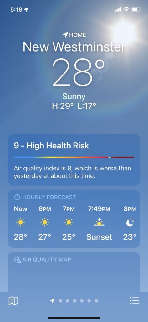
This morning, the Air Quality Index (AQI) was 3, which is a bit higher than normal. It is now 9, and shows thusly on my iPhone:
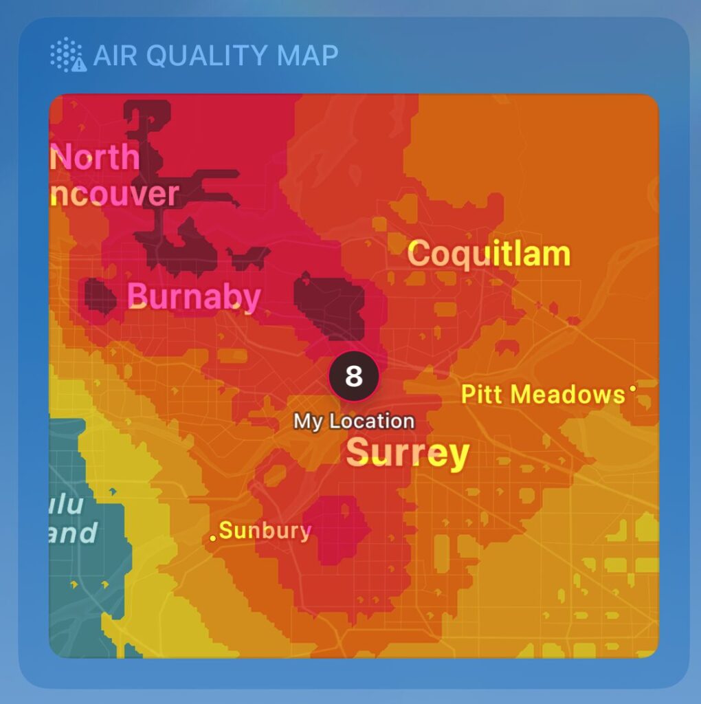
High Health Risk! Yikes. Also, it was very warm and muggy, which is probably contributing. The AQ map looks very angry:
I do not live in a Magic 8 ball, despite appearances.
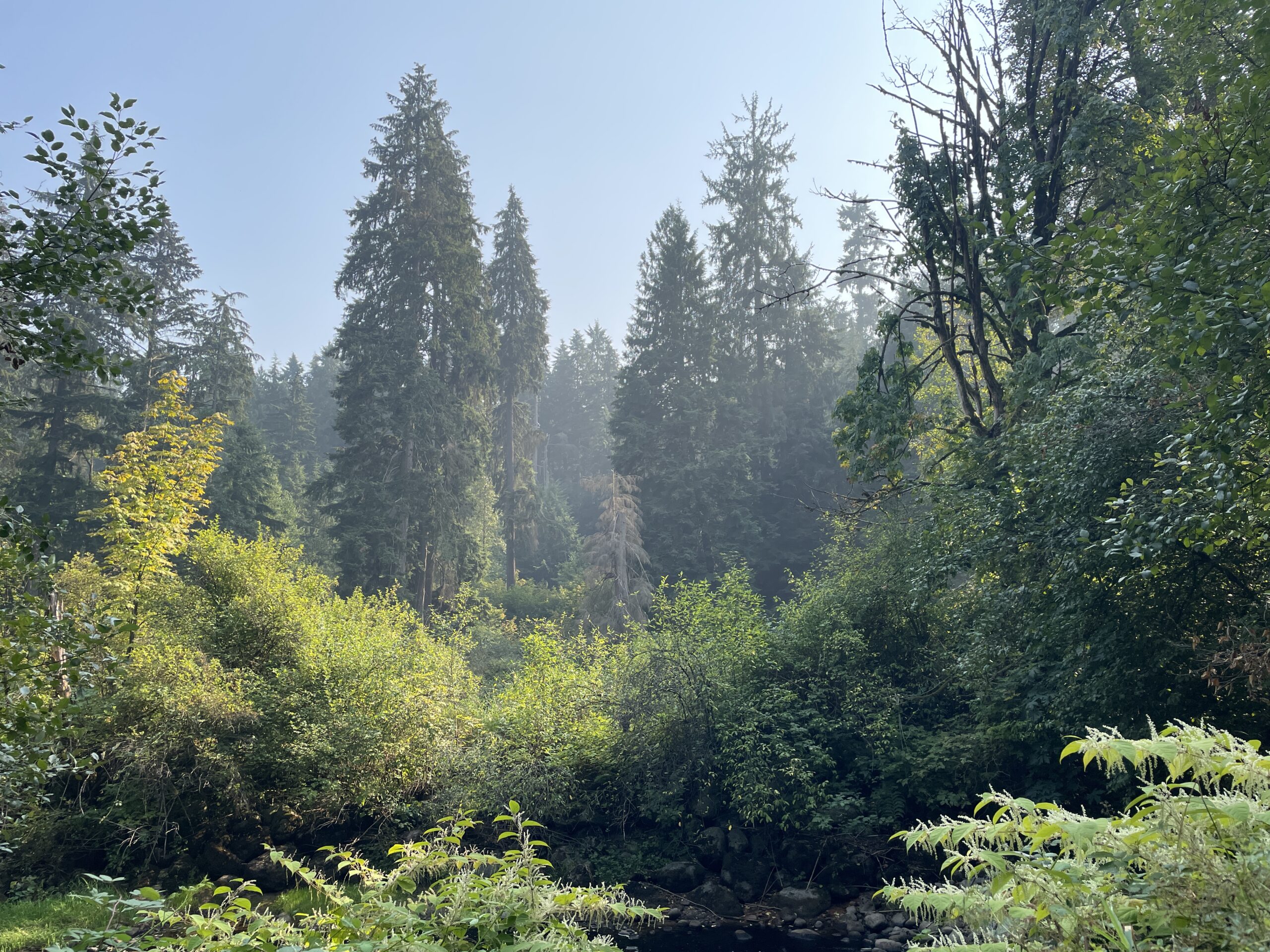
I went for a walk and it smelled just like that map:
The smoke is coming from wildfires, so in a way, we’re lucky that it didn’t get here until relatively late in the season. It’s likely to persist until we see a significant change in the weather (showers, etc.) All part of the magic of climate change!
With global warming and climate change an established thing, I have been wondering if the local climate is changing in ways that are noticeable now (rather than in 30-100 years, when predictions look a lot more dire).
This was brought on yesterday when I found my eyes involuntarily rolling upon reading another weather advisory in the Windows Weather app. They seem to be coming up more frequently. And so, just to satisfy my own curiosity in a completely unscientific manner, I am going to record the remainder of the late fall and winter advisories on a page here through the remainder of the 2021-22 season.
The first entry, from today, is below.
Nerd stuff: Since the text in the Weather pap is not normally capturable, here’s how I did it (I will find a way to streamline this process later):
Take a photo of the Weather app report on my monitor screen using my iPad
Use iOS 15’s text recognition to copy the text from the screenshot
Paste the text into iA Writer, save the file to iCloud
Open iA Writer on the PC and grab the text from there
Lovingly apply formatting to the version pasted to the blog here
Rainfall – Warning
From 11/14/2021 5:22:40 AM to 11/14/2021 9:22:40 PM rainfall warning in effect
Total rainfall up to 100 mm for Metro Vancouver, western Fraser Valley and parts of the Sunshine Coast, and up to 150 mm for Howe Sound and the eastern Fraser Valley for today and Monday. Warm temperatures will accompany the rain.
Timespan: Today to Monday.
Locations: Metro Vancouver, Fraser Valley, Howe Sound, Sunshine Coast – Gibsons to Earls Cove. Hazard: 100 to 150 mm of rain. Rising freezing levels with melting snow giving rise to increased river flows and localised flooding.
Remarks: A significant atmospheric river event will bring copious amounts of rain and near record temperatures to the B.C, south coast today through Monday.
The rain will be heaviest this afternoon and tonight ahead of the cold front. The heavy rain will ease on Monday as the cold front pushes the precipitation out of the region.
The lowlands of Metro Vancouver will see up to 75 mm of rain by Monday while the North Shore, Northeast sector including Coquitlam and Maple Ridge and Fraser Valley – West including Abbotsford could see up to 100 mm. Howe Sound and central and eastern Fraser Valley including Chilliwack and Hope could see upwards of 150 mm.
This could result in possible washouts, debris flow and pooling water as rising freezing levels will also melt snow at higher elevations, Local river levels will rise and river flows will increase as a result of the heavy rain.
Heavy downpours can cause flash floods and water pooling on roads. Localized flooding in low-lying areas is possible.
Please continue to monitor alerts and forecasts issued by Environment Canada. To report severe weather, send an email to BCstorm@ec.gc.ca or tweet reports using #BCStorm.
Watch for possible washouts near rivers, creeks and culverts.