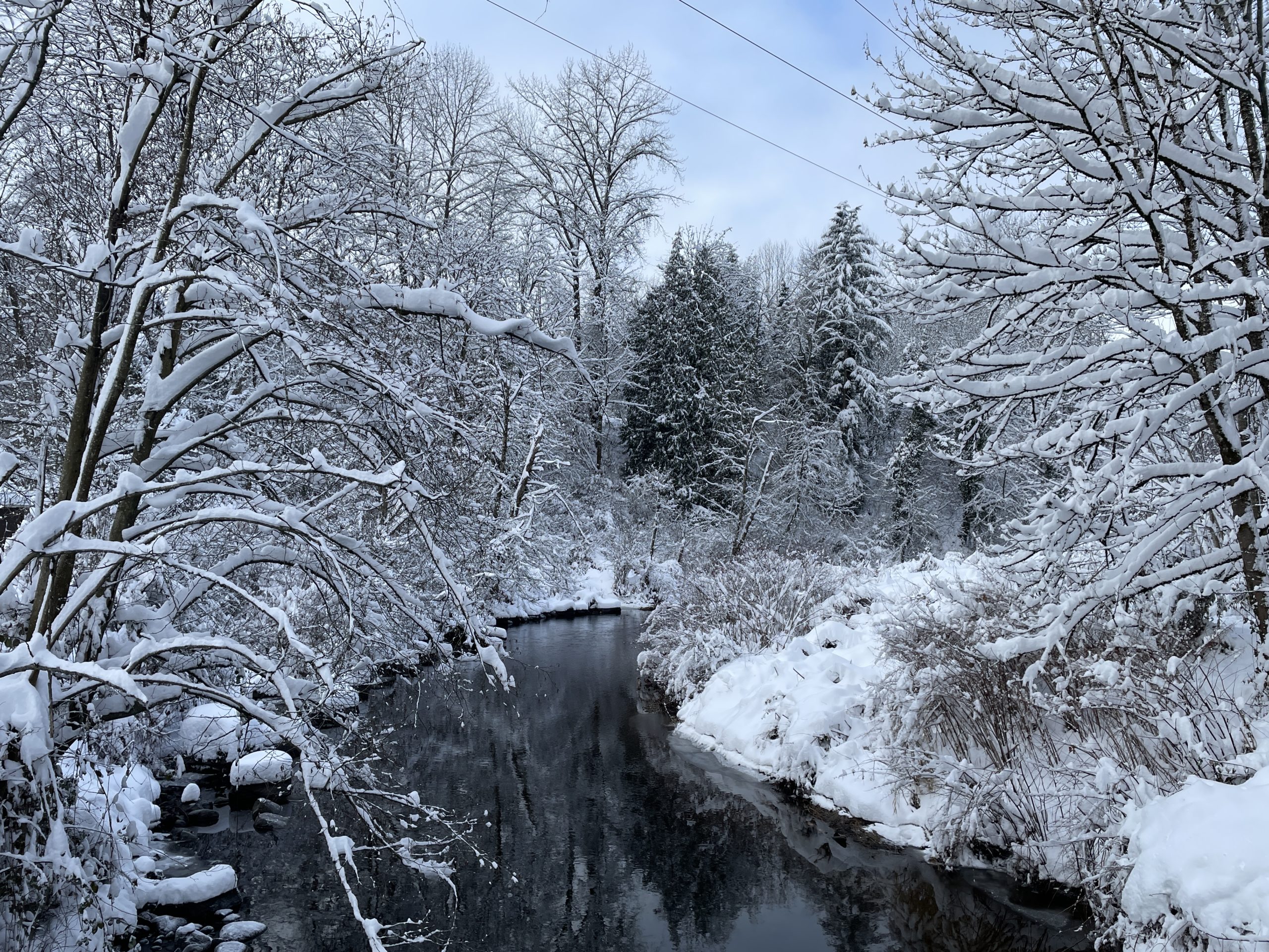
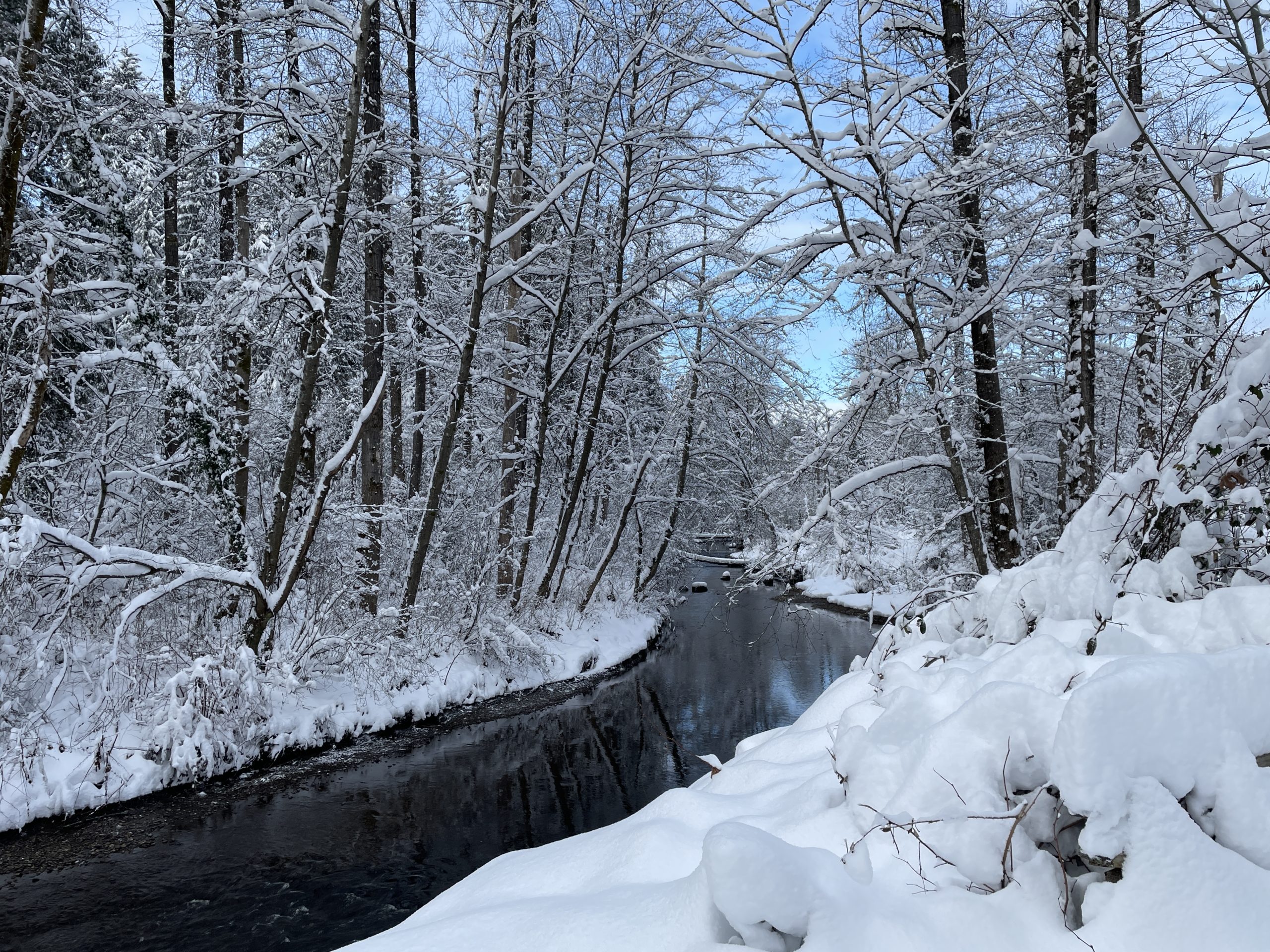
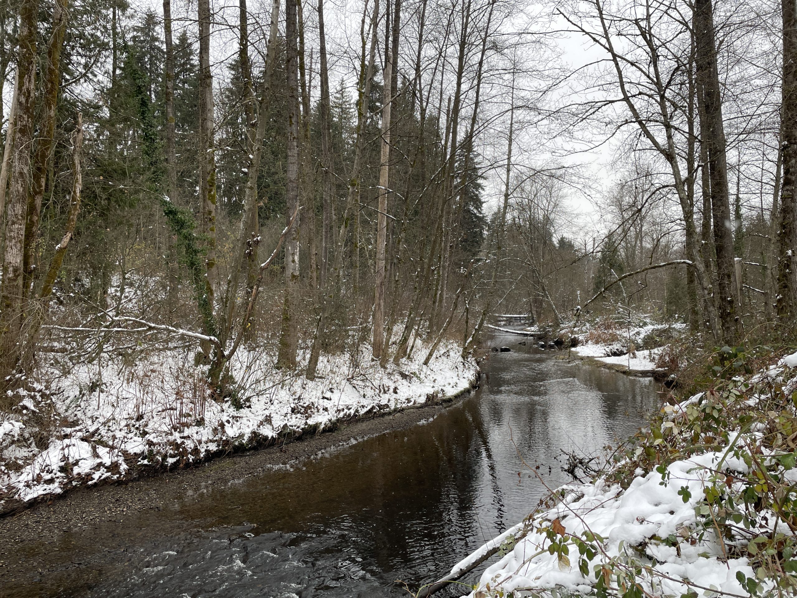
The Brunette River is looking more spring-like in this shot I took this afternoon. It was also 23C–the warmest it’s been so far this year, and a weird thing to experience after The Rains and the cold, horrible weather that has been April up till now.
The weather was nicer in January than it is now. And it snowed in January. April showers may bring May flowers, but no one will see them BECAUSE THEY WILL BE UNDER 2 METERS OF WATER.
And they’re still teasing this in the forecast:
Oh, I’ll be back in eight days to verify that it was actually 4C with snow showers on the 28th, believe me!
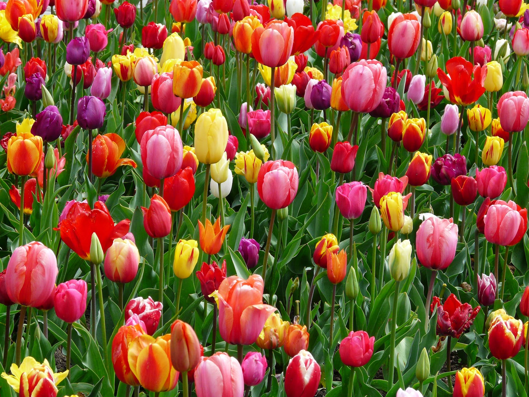
Tulips means spring. It’s the law. Photo by Pixabay on Pexels.com
In this case, the question is: How many days until spring?
This also means we have about one more month when snow is possible, after which it becomes exceedingly unlikely through mid and late March and all but impossible by April.
Though we have had snow in April.
Also, it’s only 34 days–just over a month–until accursed Pacific Standard Time gives way to better Pacific Daylight Time. This is all to say that I’ve had my fill of winter, and bring on the warmer weather and longer days.
For awhile now, the Windows 11 weather app (which I quite like–it covers all the basics and has a pleasing, subtle aesthetic) has been missing text for weather warnings or alerts. For example, right now I see this:
I mean, it’s nicely minimalist, but some text describing these dire-looking warnings would be handy!
(And yes, I used the Feedback app to report the issue, like a good interweb citizen.)
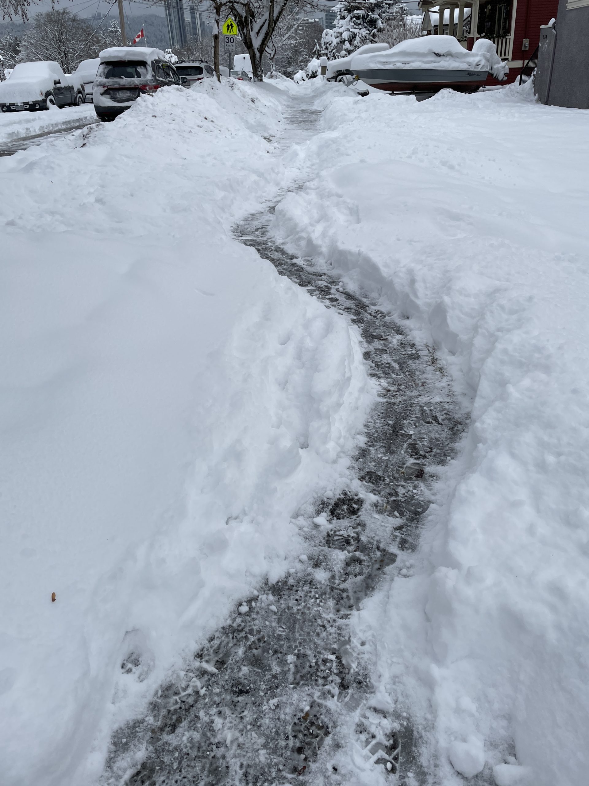
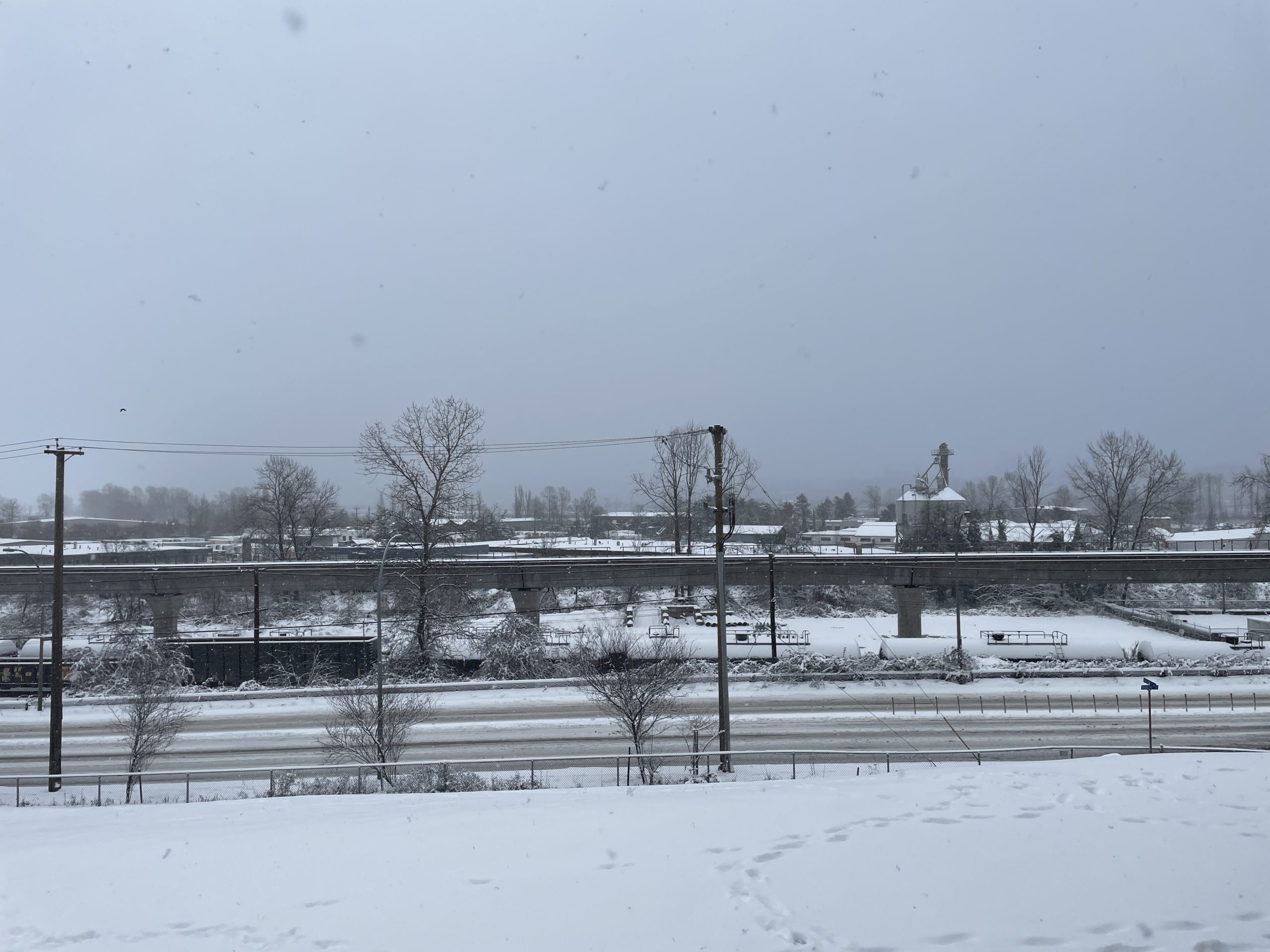
It started snowing yesterday around 1 p.m. and is still snowing at 10 a.m. the next day as I type this (though it is sputtering out at the moment).
I’ll update with more photos in a bit, but for now, the area has seen 20-30 cm of snow fall overnight, on top of a lot of snow already on the ground. Roads are a mess, the transit system is at a standstill, ferry sailings cancelled, flights from YVR delayed.
And it’s still not technically winter!
So instead of complaining, we drink hot chocolate, stay warm and wait for it to warm up, rain and wash it away.
We have some little lights installed outside, shining toward our unit. They are still working, deep inside a snow bank (shot through a window, so you can see my monitors reflecting:
Like some snow beast laying in wait…
And a short video Jeff shot on the SkyTrain this morning, before he gave up getting to work because the buses were completely absent. The trains, meanwhile, were accumulating snow…on the inside:
All aboard! If you can pry the snow-encrusted doors apart.
And some shots of the Brunette River, doing the winter wonderland thing.
And yet here we are. Today we got another dump of snow and given the forecast (mostly clear/cloudy and very cold) it’s reasonably likely we will have some kind of White Christmas, which I was not dreaming of.
Right now, we’re in the “pretty to look at” stage.
Tomorrow it will be the “snow turns to ice after a night of sub-freezing temperatures” stage, and by the end of the week it will be “here comes the slush!” Then another week before it’s finally gone. Until the next big dump. WHICH BETTER NOT HAPPEN.
Forecast:
Christmas Eve is when the slushpocalypse begins. Ho ho ho.
A picture from outside my condo, looking toward the Fraser River, which you can’t really see, but it’s there! Taken about seven or eight hours after the snow started.
My original plan was to walk the 6 km to Piper spit and take pictures of the birds. About halfway there, the snow started coming down hard enough that I turned back (my camera equipment is not really snow-compatible). But I did get some shots of snowy scenery with my phone. Enjoy these over a nice mug of hot chocolate!
View of the Brunette River from the bridge on North Road.The number of trees that have collapsed across the river has tripled in the last year. To three! You can see two of them here.Close-up of the second fallen tree, with reflection.The cold way forward. The ruts made by service vehicles weren’t as slippery as I expected.
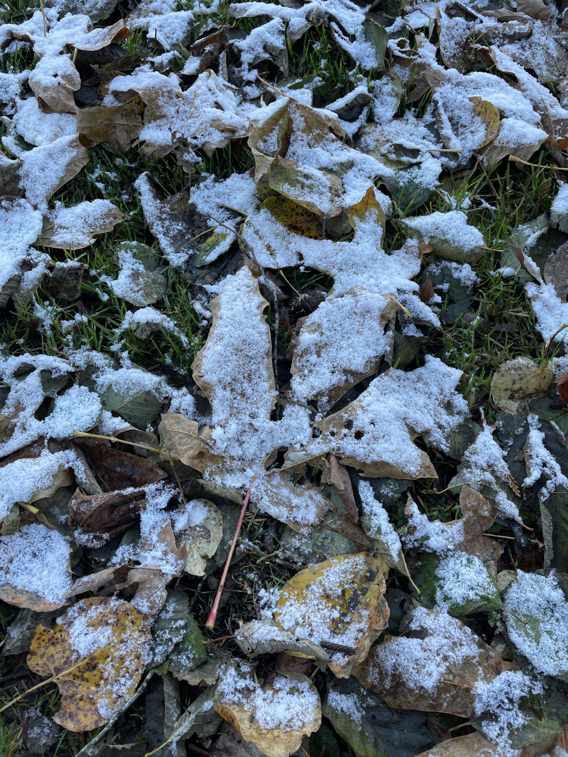
Snow, that is, which sprinkled over the area on Monday night. It’s pretty much gone now, but the mental scars from seeing snow in the second week of November will linger on.
Due to climate change and certain incidents, I feel it’s time to update the list again. Here are the best/worst running conditions. Unlike the previous entries, I’ve numbered them from best to worst, to keep things more positive or something. For the record, only the top three are really what I’d call “good” running conditions.
Overcast and light breeze. This is actually ideal conditions. It is usually never too cold or warm when the weather is like this. Temperature-wise, we’re looking at around 15C.
Moderate wind. Moderate wind is fine. I have a cap that stays in place now.
Warm sun. Warm is no big thing. I’m talking about 20ºC or thereabouts.
Light rain. You might think light rain would be nice, but it really isn’t. You still get soaked, and in the summer there’s no real way to dress for it. And it still feels cold(ish), even in mid-July.
Snow. I’ve only run in light snow a few times, and it was fun. Light snow is shallow and fluffy, so it’s easy to move through. I’m thinking a foot of snow would probably be less so.
Cold rain. Cold rain means cold hands and if you wear gloves they need to be waterproof. Cold rain is never fun. Plus my nipples are weirdly sensitive to the cold now and cold rain is like torturing them. Poor little nipples. UPDATE FOR 2022: It turns out the nipples are more sensitive to moisture more than the cold, as The Nipple Issue™ returned in Summer 2022.
Hard rain. This has the potential to wreak havoc with any non-waterproof items you may be carrying, and it’s hard to see if you wear glasses. I wear glasses.
Extreme cold. I’ve run in sub-freezing conditions and been fine. I’m thinking Arctic tundra-type cold here.
Heavy wind. The resistance means you work a lot harder to achieve the same result, and my cap has to be on tight enough to cut off circulation, so it doesn’t fly away. This is pretty rare where I run, though. And I don’t run during actual windstorms due to the very real danger of flying (tree) debris.
Hot sun. When it’s hot, my body feels like a furnace, and I’m left parched as all get-out. Dry mouth and lips are yucky. By hot, I mean high 20s and up. While it still gets hot in the summer, a new contender has arrived to usurp it. Keep reading!
Hard rain and heavy wind. Likeliest weather to make me wonder to myself, ‘What was I thinking?’ when running.
Hot sun and heavy wind. Or “What would it be like to do a run on a windy day in the Sahara?” Heat dries you out, the wind makes it harder to run and dries you out even more. Bleah. This combination is, however, pretty rare.
Hail. Getting pelted by little ice rocks is unpleasant. I’ve been caught in hail twice and did not like it either time. Still, twice since 2009 is not bad.
Cyclists. I have grown to loathe anyone on a bicycle, especially since the area where I run most frequently–Burnaby Lake–forbids bicycles, but cyclists show up anyway, sometimes in packs. They tend to be either little kids who will wobble suddenly and unpredictably in front of you, or jerks who power through as fast as they can pedal, oblivious to the presence or safety of others.
Dogs. See here. I’ve had a dog knock me down while running. The weather has never done this.
Tree roots. See here. I’ve only tripped and fallen over a tree root while jogging at full speed once, but once was enough. Fortunately, the resurfacing of the trails at Burnaby Lake means almost all exposed roots are now gone.
Hot sun/heat and high humidity. This is the new entry for 2022 (the tree root happened in 2016, but the previous version of the list was written pre-root). See how Hot sun is way up there at #10? The heat/high humidity combo is so much lower because IT IS TERRIBLE. While I don’t suffer from a parched mouth in this weather, the combo of 30C+ weather and extremely high humidity in the summer of 2022 made running a horrible slog, no matter what the time of day. It was only just less horrible, depending. And it happened for nearly the entire summer, earning its hallowed spot here.
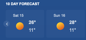
Just as the gods meteorologists predicted, today the weather has actually changed. This may not seem remarkable, but considering we’ve had virtually no rain for three months, it kind of is!
It’s currently 9C and instead of getting up to an unseasonably warm 18, 20 or 22C, the high is forecast as a mere 11C! There is actual precipitation lightly falling, even as I type this. It’s pretty crazy.
I’m sure this forecast will change, but wanted to preserve it for the record.
(For future reference, this is for October 15 and 16, 2022)
The normal temperature for October 16 is 15C, the record is 20C, so this would break the record by 8C (or over 14F if you want a larger, even more alarming number).
The stones outside the living room window were dotted with raindrops when I got up this morning. There are clouds in the sky. The forecast high is in the teens. Scattered showers are predicted. This is all very weird. Could it be summer is going away, and with it the horrible heat and humidity twins of terror and discomfort?
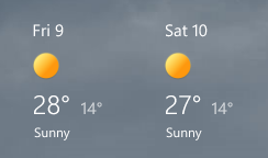
Well, maybe not entirely:
To be clear, this is for September 9 and 10, 2022.
I feel pretty good in predicting no more days of 30C for the rest of 2022, though. If I’m wrong, I will curl up and cry. And sweat. A lot.